Direct Ancestors Map:
Direct Ancestors Map
Survey of the Manor of Rotherfield 1597 (section of):
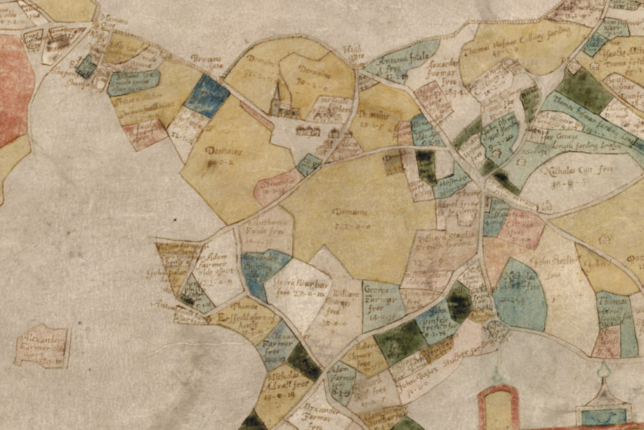
A section of the 1597 Survey of Rotherfield Manor map showing the Draper's property owned by "Georg Barbar"
The Bonnetts Property in Rotherfield, East Sussex
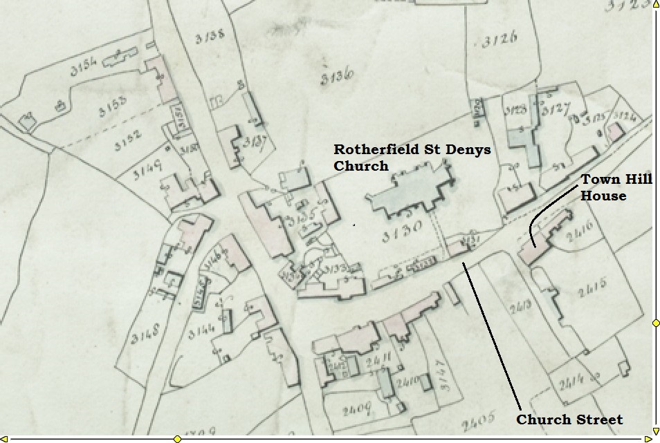
The 1842 Tithe Map of Rotherfield village showing the Bonnetts property comprising Lots 2413 (Bachelands), 2414, 2415 and the Way. The property is now known as Town Hill House.
Draper's Property on Google Maps
Drapers, Rotherfield, East Sussex
Draper's Property in Rotherfield, East Sussex on today's Google maps. Owned by the Barber family c1580 (or earlier) to 1787.
Woodside Cottage, Hildenborough - Google Maps
Woodside Cottage, Hildenborough, Kent
The cottage purchased by Widow Mary Barber in 1692 (on 1 acre at the time) and held by the Barbers until 1801. Now called Woodside Cottage. It is the house on the corner, closest to the office block.
Widow Mary Barber's Property - 1870 Ordinance Survey Map
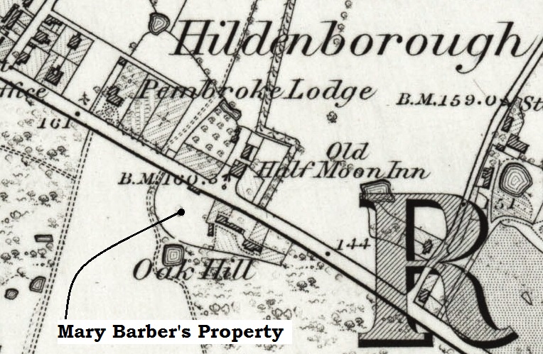
Ordinance Survey map of Hildenborough 1870 showing the Widow Mary Barber's property that she purchased in 1692.